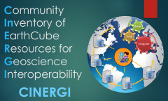
The metadata documents used by the cinergi project were all originally created and made freely available by the following agencies:
- CUAHSI, The Consortium of Universities for the Advancement of Hydrologic Science, Inc. CUAHSI is a 501(c)3 research organization representing more than 130 U.S. universities and international water science-related organizations. CUAHSI receives support from the National Science Foundation (NSF) to develop infrastructure and services for the advancement of water science in the United States
- C4P: Collaboration and Cyberinfrastructure for Paleogeoscience. C4P advances the role of cyberinfrastructure in unraveling the large-scale, long-term evolution of the Earth-Life system through the study of the geological record.
- Databib is a tool for helping people identify and locate online repositories of research data. Users and bibliographers create and curate records that describe data repositories that users can search. re3data.org
- NGDS, The National Geothermal Data System. NGDS is a catalog of documents and datasets that provide information about geothermal resources.
- Oceanography and Geobiology Environmental 'Omics This EarthCube RCN project's goal is to identify community needs and develop necessary plans to create a federated cyberinfrastructure to enable ocean and geobiology environmental ‘omics.
- OpenTopography facilitates community access to high-resolution, Earth science-oriented, topography data, and related tools and resources.
- SEN: Sediment Experimentalist Network. SEN integrates the efforts of sediment ex-perimentalists to build a knowledge base for guidance on best practices for data collection and management.
- USGIN: U.S. Geoscience Information Network. USGIN is a federated information-sharing framework that uses free and open-source technology, capable of interacting with similarly configured data-sharing networks.
- USGS Science Base. ScienceBase is an Open Source project that provides current documentation about its structure, information model, services, directory and repository.
- Data.gov: The home of the U.S. Government’s open data. Open government data is important because the more accessible, discoverable, and usable data is the more impact it can have.
- Interdisciplinary Earth Data Alliance is a community-based NSF-funded data facility to support, sustain, and advance the geosciences by providing data services for observational solid earth data from the Ocean, Earth, and Polar Sciences.
- Geoscience Australia is Australia's pre-eminent public sector geoscience organisation, and the nation's trusted advisor on the geology and geography of Australia.
- U.S. Geological Survey. USGS hosts multiple repositories on water, energy, minerals, other natural resources, the health of ecosystems and environment, the impacts of climate and land use change, natural hazards, etc. Several USGS databases are indexed in CINERGI.
- NOAA's National Centers for Environmental Information (NCEI) is responsible for preserving, monitoring, assessing, and providing public access to the Nation's treasure of climate and historical weather data and information.
- Critical Zone Observatories (CZO). The National CZO Program is a community resource serving the international scientific community through research, infrastructure, data, and models, with the focus on how components of the Critical Zone interact, shape Earth's surface, and support life.
- Registry of Research Data Repositories (re3data) lists over 1,500 research data repositories, making it the largest and most comprehensive registry of data repositories available on the web.
- U.S. Environmental Protection Agency, with its mission to protect human health and the environment, makes a large number of data sets and models freely available to scientific community.

